
Zeytin – Alakilise – Bonda T.
The Lycian road, which ascends via the path beside the dirt road at the exit of Belören settlement, reaches the settlement of Zeytin by passing a wide plain. After passing Zaytin, the dirt road is continued to be followed for a short while; afterwards the path to the right is taken. The path descends for some time and then enters the woods from among the village houses. At the hill, the dirt road is once again followed for a short while and then the road becomes a path again, descending to Alakilise.
After Alakilise, a gentle climb and then a steeper climb must be done. Passing below the archaeological remains known as Papaz Kayası, the path ascends to the top of the mountain. After this point, the path follows the hillsides and ascends through wooded areas with gentle slope. The northern route of the Lycian road, which descends from very high altitudes while providing a view of the lagoon before Beymelek, becomes unfavorable to walk in the winter due to snow buildup on the paths. It is advised for travelers who will be taking this route to carry sufficient water for this part which will take two days between Belören and Finike.
ZEYTİN NEIGHBORHOOD SETTLEMENT
In the Zeytin neighborhood, which is located around a valley and in uninhabited condition except for a few households that live among the structure remains from the ancient period, habitation has started in the classical age and continued through the Hellenistic, Roman, Byzantine and Ottoman periods, until the modern day. The agricultural terraces, cisterns and olive oil processing workshops in the neighborhood indicate that there was much agricultural activity in the area during the ancient period and that production economics was implemented in this settlement, which is related to Myra.


In the settlement, beside the current road that is 1,5 kilometers east of Alakilise, there is a square shaped structure with dimensions of approximately 10 x 10 which is made of properly cut stone. The two rows of this structure that extend south. Beginning from the slopes, many sarcophaguses are scattered throughout the area. In the location of Aylakçamur, there are structural remains at foundation level, olive processing workshops, and workshops that have been carved into the rocks for purposes of pressing grapes and producing wine. The water for the structures in the settlement area was supplied via cisterns. At the north and back of the valley, there is the necropolis area which extends from the bottom of the valley and which has been used until modern day.
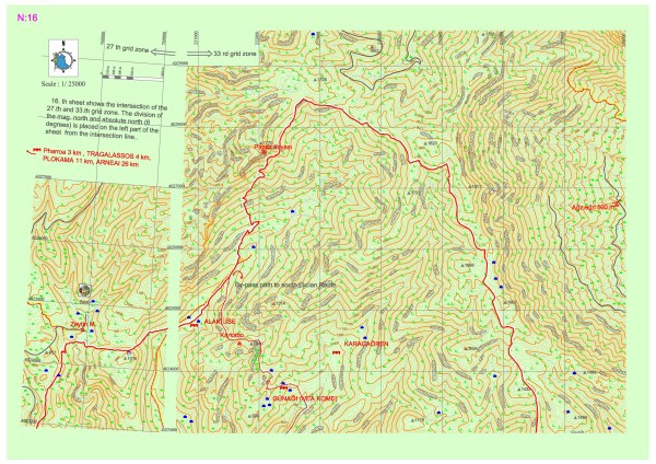
ALAKİRSE SETTLEMENT (KARKABO)
Alakilise, which is in Belören village, Alakirse location, is an early Byzantine period church from the 5th or 6th century. The church is shaped like a basilica and has three naves. There are damaged architecture pieces around the church. On east of it, there is an apse which is circular on the interior and polygonal on the exterior. On the west there are the narthex and the atrium. On the southeast there is an additional building shaped like a cross within a square. On the north of the atrium, there are 5 dome-shaped vaulted rooms and a cistern. About 1 kilometer southeast of the basilical church, there is a chapel with dimensions of 9 x 5 which has been carved into the bedrock. At the northeast of this chapel, there is a second chapel with dimensions of 11.15 x 4.90 and patches of frescoes.
On the northeast of the church, there is another settlement on the side of the current forest road with a watch tower and farm houses. On the western slope, there is a rock tomb carved into the bedrock with an entrance from the north and a sarcophagus lid on it. There are structure remains and agricultural terracing walls which are scattered all over the area.
It is understood that the name of the settlement which is located about 1 kilometer east of Alakilise on the hill is Karkabo, in accordance with the inscriptions on the narthex of Alakilise, which is dedicated to Archangel Gabriel, and the Vita Nicolae Sionitae regarding St. Nicholas. There is small church with dimensions of 10 x 5 meters in the settlement. The walls of the structure have been built out of mid-sized regional stones and lime mortar. On the northest of the church, there are two cisterns. On the north and west of the hill that is east of the church, there are remains of domiciles with their own cisterns and workshops which have been built out of large cut stones.
THE HOLY SITE OF PAPAZ KAYASI
The hill, which is colloquially called Papaz Kayası, has a full view of Demre Valley and has been used as a holy site. There are niches that have been carved into the bedrock and platforms formed with terraces shaped like steps. A small chapel with a vaulted roof which is dated back to Christianity and the Byzantine period was built on the holy site as well. There are three cisterns and architectural blocks which are ornamented with cross figures beside the chapel.
KARABEL (PHARRÕA)
This place is known to be a small tower and farm settlement related to Tragallassos in the neighborhood of Karabel. The late Hellenistic period tower has been built on a rocky ridge and has three floors. The walls of the first floor are entirely preserved while the second floor walls are partially preserved and only the southern side of the third floor walls have survived. The visible surfaces on the tower, of which floor borders can be seen, are made of rough bossage stones. The window of the tower is on the second floor, right over the entrance. There are three cisterns around the tower. The interior of the cisterns, which have been carved into stone with a diameter of approximately 2 to 3 meters, is plastered. On the west and south sides of the tower, there are remains which are presumed to have belonged to domiciles made of cut stones and olive processing workshops.
ÇAĞMAN SETTLEMENT (PLAKOMA)
This settlement is on the Muskar-Arneai road. There are too few remains here apart from the early Byzantine period church. According to the information in the Vita Nicolae Sionitae regarding St. Nicholas, three hundred people lived in Plakoma during the 6th century. The excavations in the area revealed a necropolis site on the location of Börülce Creek, dated back to the Byzantine period.
BOLDAĞ-AĞZIEĞRİ SETTLEMENT
The settlement of Karakuyu, which is one of the various settlements within the region that was called Bonda in the ancient period, on the Gülmez Mountain in the Boldağ Village within Finike District, is a Byzantine settlement on the lower side of the road that goes north after the settlements of Dinektepe and Karakuyu within the wooded area on the northwest of Kabaksarnıç Creek.
Structures that have been built out of rough stones and mortar with large stone blocks on the corners have features indicating the Byzantine period. The beam hollows on the walls of the structure which may be tower with a shape close to a square indicate that the building might have had multiple storeys. These hollows also indicate that the structure had rooms divided with thin connecting walls. The church of which the apse is at the east is one of the structures that can be seen among the rich vegetation in the settlement.
In the lower part of the road that is at the southwest of the settlement, within the wooded area, there is a watchtower which may have belonged to the late Roman or early Byzantine periods. The tower is square shaped with large cut stones on the door lintels and walls built out of rough stones; about 1,5 to 2 meters of its walls have survived.